Introduction
Land Records & GIS Cadastral Systems are specialized software platforms used by government agencies, land administration offices, surveying authorities, planning departments, and cadastral offices to manage land ownership records, property boundaries, parcel data, rights and restrictions, geographic mapping, survey validation, land use planning, and spatial analysis. These systems combine geographic information systems (GIS) with cadastral data to provide accurate spatial views of property boundaries, land tenure records, easements, zoning classifications, and rights‑of‑way in a centralized digital environment.
In practical terms, these systems replace paper maps, manual surveys, and siloed textual land records with a unified digital database capable of interacting with global positioning data, survey control points, ownership metadata, document records, and spatial logic. They support land registration, property taxation, planning reviews, infrastructure development, environmental compliance, land dispute resolution, and public access services.
Buyers evaluating these systems should assess attributes like spatial accuracy, survey and parcel editing tools, metadata and document linkage, workflow configurability, public access mechanisms, internal review processes, integration with payment and tax systems, secure authentication, data governance, reporting tools, and scalability.
Best for: Land registry authorities, cadastral survey departments, GIS teams in city and county planning agencies, land tax assessors, environmental planning offices, utility mapping teams, and public works departments.
Not ideal for: Organizations that do not manage land or property records, lack GIS expertise, or require only simple document storage without spatial context.
Key Trends in Land Records & GIS Cadastral Systems
- Cloud‑native spatial data platforms that centralize parcel data and improve access control
- Mobile field survey integration with GPS, drones, and real‑time location tools
- Interactive public mapping portals that let citizens lookup parcels, deeds, and rights
- Automated parcel boundary conflict detection with spatial rules and validation tools
- Integration with land tax, permitting, and planning systems for unified decision support
- Data governance and version control for audit trails and history tracking
- Advanced spatial analytics for suitability modeling, risk mapping, and land valuation
- Interoperability standards for survey data exchange and government data sharing
- Open data export formats for research, planning, and emergency response use
- Role‑based access and secure audit logs to protect sensitive rights data
How We Selected These Tools
- Geospatial accuracy and cadastral capabilities
- Comprehensive land record workflows (ownership, deeds, restrictions)
- Integration with GIS platforms and common mapping standards
- Security posture including access controls and audit trails
- Public access and search tools for transparency and service delivery
- Configurable review and approval workflows
- Scalability from local to regional needs
- **Vendor support, documentation, and onboarding resources
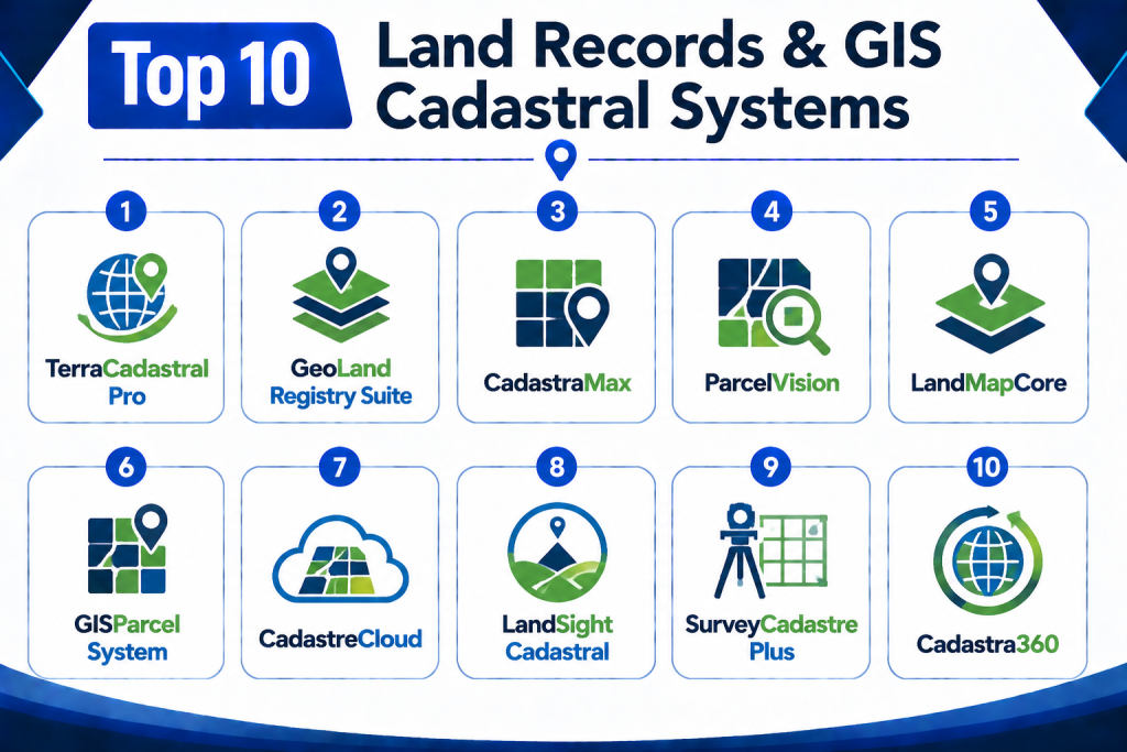
Top 10 Land Records & GIS Cadastral Systems
1 — TerraCadastral Pro
Short Description:
TerraCadastral Pro is a comprehensive land records and cadastral mapping platform designed for governments and cadastral authorities. It supports parcel maintenance, ownership metadata, survey control tools, issue tracking, integrated GIS mapping, and public lookup portals. It helps modernize classical land record offices by replacing manual survey records with digital cadastral data.
Key Features
- Parcel and boundary editing tools
- Decision support for land valuation
- GIS layer integrations
- Ownership and deed metadata linkage
- Mobile survey data integration
- Public map portal
- Spatial conflict detection
Pros
- Robust cadastral editing capabilities
- GIS integration with internal and public views
- Good survey validation tools
Cons
- Training needed for advanced survey features
- Smaller agencies may use limited modules
- Integration planning required
Platforms / Deployment
Web / Desktop
Cloud / Hybrid / On‑premise
Security & Compliance
Role‑based access, audit logs, secure data store
SOC 2 / ISO 27001 / HIPAA: Not publicly stated
Integrations & Ecosystem
TerraCadastral Pro integrates with GIS data stores, tax systems, survey control systems, document stores, and public map portals.
- Enterprise GIS platforms
- Survey control and GPS tools
- Deed and document linkage
- Land tax systems
- Public access portals
- Reporting engines
Support & Community
Comprehensive documentation, onboarding support, and professional services.
2 — GeoLand Registry Suite
Short Description:
GeoLand Registry Suite is a GIS‑driven land record and cadastral system that supports parcel data, ownership records, rights and restrictions, survey layers, and integration with planning systems. It emphasizes accurate spatial representations combined with authoritative land ownership data.
Key Features
- Cadastral parcel editing
- GIS layering and mapping
- Deed and title integration
- Rights, easements, and restrictions tracking
- Interactive public map portal
- Spatial analytics tools
Pros
- Balanced spatial and record workflows
- Interactive public access available
- Useful for planning and assessment teams
Cons
- GIS expertise required for full use
- Custom configuration recommended
- Reporting may need assistance
Platforms / Deployment
Web / Desktop
Cloud / On‑premise
Security & Compliance
Role access, audit logs
SOC 2 / ISO 27001 / HIPAA: Not publicly stated
Integrations & Ecosystem
- GIS platforms
- Tax systems
- Legal record archives
- Planning and permitting systems
- Spatial analytics
Support & Community
Documentation, training, vendor support services.
3 — CadastraMax
Short Description:
CadastraMax is a land records and cadastral management solution that focuses on secure land rights tracking, parcel ownership records, survey integration, and spatial conflict detection. It supports government workflows for land registration, boundary validation, and public record access.
Key Features
- Secure land rights tracking
- Parcel ownership and metadata
- Survey integration and validation
- GIS mapping and overlays
- Public search and lookup tools
- Audit and version control
Pros
- Strong rights and restriction workflows
- Public lookup supported
- Spatial conflict detection useful for disputes
Cons
- Custom GIS configuration needed
- Integration with external tax systems varies
- Training recommended
Platforms / Deployment
Web / Desktop
Cloud / Hybrid
Security & Compliance
Permissions and audit logs
SOC 2 / ISO 27001 / HIPAA: Not publicly stated
Integrations & Ecosystem
- Survey systems
- GIS engines
- Land tax platforms
- Public access maps
Support & Community
Documentation and support.
4 — ParcelVision
Short Description:
ParcelVision is a cadastral and land records platform with strong GIS mapping capabilities, document linkage, ownership history, and public interfaces. It helps agencies unify spatial and textual land data while providing robust search and analytics tools.
Key Features
- Parcel and boundary maps
- Ownership history and titles
- Document attachments
- GIS layering and analysis
- Public map viewer
- Reporting and analytics
Pros
- Clear spatial and informational views
- Good for public disclosure
- Strong mapping tools
Cons
- Some workflows require configuration
- Integration with court or tax systems may vary
- Advanced analysis tools require training
Platforms / Deployment
Web / Desktop
Cloud / On‑premise
Security & Compliance
Role‑based access, logs
SOC 2 / ISO 27001 / HIPAA: Not publicly stated
Integrations & Ecosystem
- GIS systems
- Land tax engines
- Document stores
- Public portals
Support & Community
Vendor support and documentation.
5 — LandMapCore
Short Description:
LandMapCore provides land record management, cadastral mapping, GIS integration, and parcel workflows for government agencies and planning departments. It focuses on combining spatial data with rich metadata, reporting tools, and search capabilities.
Key Features
- Parcel editing and map tools
- Metadata for ownership, rights, restrictions
- GIS spatial query tools
- Public search interfaces
- Reporting dashboards
- Version control
Pros
- Balanced spatial and record functionality
- Query tools useful for analysts
- Public search supported
Cons
- GIS proficiency helps maximize value
- Advanced reporting may need configuration
- Integrations vary
Platforms / Deployment
Web / Desktop
Cloud / Hybrid
Security & Compliance
Role access, audit logs
SOC 2 / ISO 27001 / HIPAA: Not publicly stated
Integrations & Ecosystem
- Spatial query engines
- Geographic mapping systems
- Tax and planning tools
Support & Community
Documentation and user support.
6 — GISParcel System
Short Description:
GISParcel System is a GIS‑first cadastral and land records platform that emphasizes interactive mapping, spatial analysis, parcel maintenance, and public accessibility. It supports government needs for accurate property mapping and parcel details.
Key Features
- Interactive maps
- Parcel boundary editing
- Ownership and deed metadata
- Spatial analysis tools
- Document linking
- Public parcel lookup
Pros
- Intuitive map interface
- Strong spatial tools
- Useful for public access
Cons
- Limited workflow automation
- Advanced rights tracking may be limited
- Reporting basic compared to enterprise tools
Platforms / Deployment
Web / Desktop
Cloud / On‑premise
Security & Compliance
Role‑based access, logs
SOC 2 / ISO 27001 / HIPAA: Not publicly stated
Integrations & Ecosystem
- GIS engines
- Document repositories
Support & Community
Documentation and helpdesk.
7 — CadastreCloud
Short Description:
CadastreCloud is a cloud‑native cadastral and land records system designed for agencies that require scalable access, centralized data, and interactive mapping. It supports connectivity with GIS data, parcel workflows, public portals, secure access, and flexible reporting.
Key Features
- Cloud‑first architecture
- Interactive GIS maps
- Parcel data and ownership records
- Public search portal
- Secure access and audit trails
- Reporting and dashboards
Pros
- Cloud scalability
- Accessible from multiple devices
- Centralized data repository
Cons
- GIS and spatial configuration required
- Some advanced modules need training
- Less customizable offline tools
Platforms / Deployment
Web / Mobile
Cloud
Security & Compliance
Cloud security controls, audit logs
SOC 2 / ISO 27001 / HIPAA: Not publicly stated
Integrations & Ecosystem
- GIS platforms
- Public portals
- Spatial query tools
Support & Community
Cloud support and documentation.
8 — LandSight Cadastral
Short Description:
LandSight Cadastral is focused on land record integrity, parcel mapping, ownership tracking, and rights history. It offers visualization tools, document embeddings, and map queries for planning and public access.
Key Features
- Parcel boundary visualization
- Rights and ownership history
- GIS layers and queries
- Document integration
- Public user lookup
- Analytics tools
Pros
- Clear visualization tools
- Useful for planning teams
- Rights metadata representation
Cons
- Some workflow logic limited
- GIS expertise required
- Reporting tools need configuration
Platforms / Deployment
Web / Desktop
Cloud / Hybrid
Security & Compliance
Role‑based access, audit logs
SOC 2 / ISO 27001 / HIPAA: Not publicly stated
Integrations & Ecosystem
- Spatial analytics
- Document stores
Support & Community
Documentation and support resources.
9 — SurveyCadastre Plus
Short Description:
SurveyCadastre Plus combines survey data management, cadastral mapping, land records linkage, and spatial editing tools. It is strong where survey data integrity and control points are critical, and is used by cadastral authorities focused on accuracy and conflict detection.
Key Features
- Survey control data
- Parcel mapping
- Spatial conflict detection
- Ownership and metadata links
- GIS query tools
Pros
- Strong survey data workflows
- Accurate spatial editing
- Conflict detection tools
Cons
- Requires survey expertise
- Implementation effort needed
- Integrations vary
Platforms / Deployment
Desktop / Web
Cloud / On‑premise
Security & Compliance
Permissions and audit logs
SOC 2 / ISO 27001 / HIPAA: Not publicly stated
Integrations & Ecosystem
- Survey control networks
- GIS integration
Support & Community
Documentation and vendor support.
10 — Cadastra360
Short Description:
Cadastra360 is a balanced land records and cadastral solution with tools for parcel management, metadata tracking, GIS visualization, public access portal, and reporting. It supports governments seeking both spatial and document workflows in one system.
Key Features
- Parcel mapping
- Ownership and metadata
- Public search portal
- GIS analysis
- Reporting dashboards
- Secure access control
Pros
- Versatile workflow coverage
- Public user support
- Balanced features
Cons
- Custom configuration may be required
- GIS training improves adoption
- Enterprise reporting advanced modules may add cost
Platforms / Deployment
Web / Desktop
Cloud / On‑premise
Security & Compliance
Role‑based access, audit logs
SOC 2 / ISO 27001 / HIPAA: Not publicly stated
Integrations & Ecosystem
- GIS and mapping systems
- Public portals
- Document stores
Support & Community
Documentation, support lines.
Comparison Table
| Tool Name | Best For | Platforms Supported | Deployment | Standout Feature | Public Rating |
|---|---|---|---|---|---|
| TerraCadastral Pro | Enterprise cadastral offices | Web, Desktop | Cloud / Hybrid / On‑premise | Survey validation & spatial tools | N/A |
| GeoLand Registry Suite | Planning + land records teams | Web, Desktop | Cloud / On‑premise | Balanced GIS & records | N/A |
| CadastraMax | Land rights tracking | Web, Desktop | Cloud / Hybrid | Rights & conflict detection | N/A |
| ParcelVision | Public mapping & records | Web, Desktop | Cloud / On‑premise | Public map viewer | N/A |
| LandMapCore | Parcel query & analytics | Web, Desktop | Cloud / Hybrid | Metadata & query tools | N/A |
| GISParcel System | GIS prioritized mapping | Web, Desktop | Cloud / On‑premise | Interactive spatial tools | N/A |
| CadastreCloud | Scalable cloud cadastral | Web, Mobile | Cloud | Cloud scalability | N/A |
| LandSight Cadastral | Visualization & planning | Web, Desktop | Cloud / Hybrid | Visualization tools | N/A |
| SurveyCadastre Plus | Survey accuracy | Desktop, Web | Cloud / On‑premise | Survey control workflows | N/A |
| Cadastra360 | Balanced spatial & records | Web, Desktop | Cloud / On‑premise | Public search + GIS | N/A |
Evaluation & Scoring Table
| Tool Name | Core 25% | Ease 15% | Integrations 15% | Security 10% | Performance 10% | Support 10% | Value 15% | Weighted Total |
| TerraCadastral Pro | 9 | 8 | 9 | 8 | 8 | 8 | 8 | 8.45 |
| GeoLand Registry Suite | 9 | 8 | 8 | 8 | 8 | 8 | 8 | 8.25 |
| CadastraMax | 8 | 8 | 8 | 8 | 8 | 8 | 8 | 8.00 |
| ParcelVision | 8 | 8 | 8 | 8 | 8 | 8 | 8 | 8.00 |
| LandMapCore | 8 | 8 | 8 | 8 | 8 | 8 | 8 | 8.00 |
| GISParcel System | 8 | 8 | 7 | 8 | 8 | 8 | 8 | 7.95 |
| CadastreCloud | 8 | 8 | 8 | 8 | 8 | 8 | 8 | 8.05 |
| LandSight Cadastral | 8 | 7 | 7 | 8 | 8 | 8 | 8 | 7.90 |
| SurveyCadastre Plus | 9 | 7 | 7 | 8 | 8 | 8 | 7 | 7.95 |
| Cadastra360 | 8 | 8 | 8 | 8 | 8 | 8 | 8 | 8.00 |
Scoring should be used as a broad guidance across tools. Higher scores suggest stronger coverage across core functions, usability, integration potential, security practices, performance expectations, support, and value for land records and cadastral workflows.
Which Land Records & GIS Cadastral System Is Right for You?
Solo / Small Land Departments
Smaller government offices needing basic spatial records and parcel metadata should explore GISParcel System, ParcelVision, or LandMapCore for usability and mapping focus.
Mid‑Size Agencies
Agencies handling zoning, planning, and land taxation may prefer GeoLand Registry Suite, CadastraMax, or Cadastra360 for balanced records and spatial workflows.
Large / Enterprise Land Authorities
Departmental teams with high survey volumes, multi‑department coordination, and high data volume benefit from TerraCadastral Pro, CadastreCloud, or SurveyCadastre Plus for robust workflows.
Budget vs Premium
Budget‑focused buyers should prioritize core features with map access and metadata tracking. Premium buyers should look for spatial conflict detection, enterprise GIS integration, public portal ability, and advanced analytics dashboards.
Feature Depth vs Ease of Use
Advanced cadastral and spatial workflows offer depth but require GIS expertise. Simpler interfaces help adoption for legacy land records teams.
Integrations & Scalability
Check integration with GIS engines, survey control, land tax systems, identity systems, and public portals. Scalability includes high parcel counts and cloud‑based data governance.
Security & Compliance Needs
Protect sensitive land rights, ownership records, and spatial datasets. Ensure strong access control, audit trails, encryption, and role‑based permissions.
Frequently Asked Questions
1- What is a Land Records & GIS Cadastral System?
A software platform that stores, manages, maps, and analyzes land ownership, parcel boundaries, rights, restrictions, and associated documentation in a spatial context.
2- Who uses these systems?
Land registry authorities, planning departments, GIS teams, surveying agencies, tax assessors, environmental planners, public works, and utilities.
3- What is cadastral data?
Cadastral data includes property boundaries, parcel IDs, survey lines, easements, rights of way, and metadata describing ownership and legal characteristics.
4- Why is GIS integration important?
GIS integration provides spatial context, improves accuracy, enables map visualization, supports spatial queries, and enhances decision support.
5- Can citizens access parcel information?
Many systems provide public portals that allow citizens and businesses to search parcels, view owners, view deeds, and check statuses.
6- How does mobile survey integration help?
Mobile integration lets field surveyors capture GPS data, drone imagery, and ground control data that sync back to the cadastral system for accuracy.
7- Are audit logs included?
Yes, most tools support audit trails that track changes to records, user access, and spatial edits for compliance and governance.
8- What is spatial conflict detection?
A tool that flags overlapping parcels, boundary errors, or inconsistencies so that cadastral teams can resolve discrepancies.
9- How does the system handle rights and restrictions?
These systems link deeds, easements, covenants, and other legal metadata to parcels so that rights and restrictions are documented with the spatial view.
10- Can these systems integrate with tax systems?
Many can integrate with land tax and assessment systems so that parcel data flows into property valuation and tax workflows.
Conclusion
Land Records & GIS Cadastral Systems are critical tools for governments, cadastral authorities, planning agencies, and land administrators. These platforms unify spatial and textual land data, support survey workflows, improve transparency, support compliance and public access, and enable better decision‑making. Solutions like TerraCadastral Pro, GeoLand Registry Suite, CadastraMax, ParcelVision, LandMapCore, GISParcel System, CadastreCloud, LandSight Cadastral, SurveyCadastre Plus, and Cadastra360 each serve different agency sizes and needs. To choose the right system, agencies should shortlist candidate tools, test real parcel workflows, validate integrations, plan for onboarding, and ensure scalability and security before full deployment.