Introduction
Drone flight planning software is specialized software used to design, manage, and optimize drone missions for commercial, industrial, and research applications. These platforms enable operators to pre-plan flight paths, set waypoints, optimize camera angles, control autonomous flight patterns, and comply with regulatory and safety requirements. By integrating with GPS, sensors, and mapping data, drone flight planning software helps organizations capture high-quality imagery and data efficiently and safely.
In, drone operations have become integral to industries such as construction, agriculture, surveying, inspection, public safety, and environmental monitoring. Flight planning software ensures compliance with airspace regulations, reduces mission risks, improves data quality, and automates repetitive flight tasks.
Real-world use cases include agricultural crop monitoring, construction site mapping, infrastructure inspection, environmental surveys, emergency response, search and rescue operations, aerial photography, forestry monitoring, urban planning, and inspection of powerlines and pipelines.
Evaluation Criteria for Buyers:
Ease of flight planning and automation, 3D mapping support, sensor integration, regulatory compliance management, multi-drone fleet management, data capture automation, mobile and tablet support, integration with GIS or mapping software, real-time monitoring, and support/training availability.
Best for: Surveyors, agricultural analysts, construction managers, inspection teams, emergency responders, environmental scientists, GIS specialists, and drone service providers.
Not ideal for: Hobbyists or organizations requiring only manual, non-automated flight control.
Key Trends in Drone Flight Planning Software
- AI-assisted autonomous flight and obstacle avoidance
- Multi-drone mission planning for fleet operations
- Integration with GIS, mapping, and BIM software
- Cloud-based mission management for real-time monitoring
- Automated data capture for imaging and LiDAR sensors
- Regulatory compliance and no-fly zone integration
- Mobile and tablet-based mission control
- 3D route visualization and terrain modeling
- Real-time telemetry dashboards and analytics
- Simulation and virtual testing before live flights
How We Selected These Tools
- Adoption by commercial, industrial, and public safety operators
- Feature completeness for flight planning, automation, and data capture
- Multi-drone and fleet management capabilities
- Integration with GIS, CAD, LiDAR, and imaging systems
- Real-time telemetry and analytics capabilities
- Compliance with airspace and safety regulations
- Mobile and cloud deployment support
- Vendor support, documentation, and community
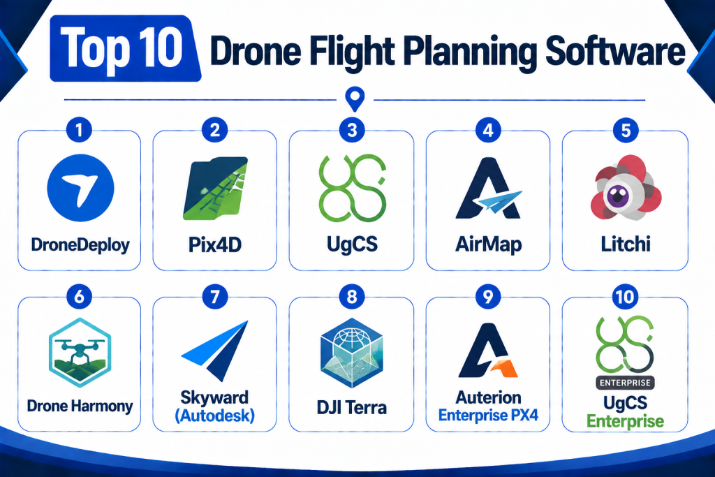
Top 10 Drone Flight Planning Software
1 — DroneDeploy
Short Description:
DroneDeploy is a cloud-based platform for drone flight planning, mapping, and data analysis. It is widely used for agriculture, construction, and inspection operations, providing automated mission planning and real-time monitoring.
Key Features
- Automated flight path planning
- 3D mapping and orthomosaic creation
- Integration with LiDAR and multispectral sensors
- Multi-drone fleet support
- Real-time telemetry
- Cloud-based data storage
- Analytics dashboards
Pros
- Intuitive interface for operators
- Strong integration with mapping and GIS tools
- Supports multiple drone models
Cons
- Subscription costs for advanced features
- Some analytics tools require high-performance hardware
- Internet connection needed for cloud features
Platforms / Deployment
Web / Mobile
Cloud
Security & Compliance
Role-based access, encryption, audit logs
SOC 2 / ISO 27001: Not publicly stated
Integrations & Ecosystem
- GIS and mapping tools
- LiDAR sensors
- Construction and agriculture analytics platforms
Support & Community
Vendor support, documentation, and user community.
2 — Pix4D
Short Description:
Pix4D provides drone flight planning and photogrammetry software for mapping, surveying, and construction. It converts aerial imagery into actionable 2D maps and 3D models.
Key Features
- Automated mission planning
- 2D orthomosaic and 3D reconstruction
- LiDAR and multispectral integration
- Field and cloud workflow
- Real-time monitoring and telemetry
- Mobile flight control
- Data analytics and reporting
Pros
- Accurate mapping and modeling
- Integrated 3D visualization
- Supports various drone sensors
Cons
- Licensing cost can be high
- Complex interface for beginners
- Requires high-spec computer for processing
Platforms / Deployment
Web / Desktop / Mobile
Cloud / On-premise
Security & Compliance
Role-based access, encrypted data
SOC 2 / ISO 27001: Not publicly stated
Integrations & Ecosystem
- GIS platforms
- BIM/CAD tools
- Cloud storage and analytics
Support & Community
Documentation, tutorials, and support plans.
3 — UgCS
Short Description:
UgCS is a mission planning software that supports precise waypoint-based flight planning, automated routes, and multi-drone operations for professional UAV missions.
Key Features
- Waypoint mission planning
- Terrain-following flight
- Multi-drone coordination
- 3D flight path visualization
- Real-time telemetry
- GIS integration
- Scripting for complex missions
Pros
- Precise control over flight paths
- Supports complex missions
- Fleet management capabilities
Cons
- Desktop-centric interface
- Learning curve for advanced features
- Subscription cost for premium features
Platforms / Deployment
Desktop / Mobile
Cloud / On-premise / Hybrid
Security & Compliance
Encrypted data, role-based access
SOC 2 / ISO 27001: Not publicly stated
Integrations & Ecosystem
- GIS and mapping software
- LiDAR and sensors
- Cloud storage
Support & Community
Vendor documentation, support, and forums.
4 — AirMap
Short Description:
AirMap provides airspace intelligence, drone traffic management, and flight planning tools for commercial UAV operators, emphasizing compliance and safety.
Key Features
- Airspace and no-fly zone alerts
- Flight planning and scheduling
- Multi-drone coordination
- Real-time telemetry
- Regulatory compliance management
- Mobile and web access
Pros
- Strong focus on airspace safety
- Multi-drone traffic coordination
- Mobile-friendly interface
Cons
- Limited mapping analytics
- Requires internet connectivity
- Some features subscription-only
Platforms / Deployment
Web / Mobile
Cloud
Security & Compliance
Role-based access, encrypted communication
SOC 2 / ISO 27001: Not publicly stated
Integrations & Ecosystem
- GIS platforms
- Regulatory databases
- Cloud telemetry
Support & Community
Documentation, vendor support, and community resources.
5 — Litchi
Short Description:
Litchi is a consumer-friendly flight planning app that supports waypoint missions, panorama, and orbit modes, primarily for DJI drones.
Key Features
- Waypoint mission creation
- Orbit, panorama, and follow-me modes
- Mobile app control
- GPS tracking and telemetry
- Video and photo automation
Pros
- User-friendly interface
- Supports multiple DJI drones
- Affordable subscription
Cons
- Limited professional analytics
- No multi-drone support
- Focused on DJI ecosystem
Platforms / Deployment
Mobile (iOS/Android)
Cloud / Local mission storage
Security & Compliance
Local storage and access control
SOC 2 / ISO 27001: Not publicly stated
Integrations & Ecosystem
- DJI drones
- Cloud storage services
- Video editing software
Support & Community
Documentation, user forums, online tutorials.
6 — Drone Harmony
Short Description:
Drone Harmony provides automated flight planning and inspection mission design, including terrain-following and industrial inspection workflows.
Key Features
- Automated flight planning
- 3D route visualization
- Obstacle avoidance
- Multi-drone support
- Industrial inspection templates
- GIS and CAD integration
Pros
- Supports industrial inspection missions
- Efficient 3D route planning
- Safety and obstacle features
Cons
- Pricing may be high
- Desktop-centric
- Learning curve for complex missions
Platforms / Deployment
Desktop / Mobile
Cloud / Hybrid
Security & Compliance
Role-based access, encrypted missions
SOC 2 / ISO 27001: Not publicly stated
Integrations & Ecosystem
- CAD/BIM systems
- GIS tools
- Sensor payloads
Support & Community
Vendor support and documentation.
7 — Skyward (Autodesk)
Short Description:
Skyward provides drone flight planning, fleet management, and airspace intelligence for enterprises, emphasizing compliance and operational efficiency.
Key Features
- Flight planning and scheduling
- Fleet management
- Airspace and regulatory compliance
- Telemetry and logging
- Mobile and web dashboards
- Automated reporting
Pros
- Enterprise-grade management
- Compliance-focused
- Cloud-based mission monitoring
Cons
- Enterprise subscription costs
- Less flexible for small teams
- Limited advanced analytics
Platforms / Deployment
Web / Mobile
Cloud
Security & Compliance
Encrypted data, role-based access
SOC 2 / ISO 27001: Not publicly stated
Integrations & Ecosystem
- GIS systems
- Cloud storage
- Regulatory databases
Support & Community
Vendor support, training, and documentation.
8 — DJI Terra
Short Description:
DJI Terra is an all-in-one mapping and flight planning tool for DJI drones, supporting 3D reconstruction, orthomosaics, and survey workflows.
Key Features
- Waypoint flight planning
- 2D and 3D mapping
- Real-time telemetry
- Sensor and camera integration
- Survey and inspection tools
Pros
- Optimized for DJI drones
- Easy-to-use mapping tools
- 3D reconstruction capabilities
Cons
- Limited to DJI ecosystem
- Desktop-focused
- Licensing required for full features
Platforms / Deployment
Desktop / Mobile
Cloud / On-premise
Security & Compliance
Encrypted missions, local storage
SOC 2 / ISO 27001: Not publicly stated
Integrations & Ecosystem
- DJI drones
- GIS platforms
- CAD/BIM tools
Support & Community
Vendor support and tutorials.
9 — Auterion Enterprise PX4
Short Description:
Auterion Enterprise PX4 is a professional flight planning software and drone operating system supporting multi-drone operations, autonomous missions, and industrial applications.
Key Features
- Autonomous mission planning
- Fleet and payload management
- Multi-drone support
- API and SDK integration
- 3D mapping and visualization
Pros
- Open ecosystem with PX4
- Multi-drone and industrial support
- Scalable for large operations
Cons
- Technical setup required
- Learning curve for enterprise operations
- Subscription/licensing needed
Platforms / Deployment
Web / Desktop / Mobile
Cloud / Hybrid
Security & Compliance
Role-based access, encrypted telemetry
SOC 2 / ISO 27001: Not publicly stated
Integrations & Ecosystem
- PX4 drones
- GIS and mapping systems
- Sensor payloads
Support & Community
Documentation, vendor support, and developer community.
10 — UgCS Enterprise
Short Description:
UgCS Enterprise is designed for industrial drone operations, enabling mission planning for inspections, mapping, and large-scale survey projects with terrain awareness and fleet coordination.
Key Features
- Waypoint mission planning
- Terrain following
- Multi-drone coordination
- 3D route visualization
- CAD/BIM integration
- Real-time telemetry
Pros
- Industrial-grade reliability
- Multi-drone management
- Advanced flight path planning
Cons
- Subscription/licensing cost
- Desktop-focused
- Advanced features require training
Platforms / Deployment
Desktop / Mobile
Cloud / Hybrid
Security & Compliance
Encrypted missions, access controls
SOC 2 / ISO 27001: Not publicly stated
Integrations & Ecosystem
- CAD/BIM
- GIS systems
- Sensor payloads
Support & Community
Vendor support, training, and documentation.
Comparison Table
| Tool Name | Best For | Platforms | Deployment | Standout Feature | Public Rating |
|---|---|---|---|---|---|
| DroneDeploy | Mapping & inspections | Web / Mobile | Cloud | Cloud-based automation | N/A |
| Pix4D | Survey & construction | Desktop / Web / Mobile | Cloud / Hybrid | 2D & 3D reconstruction | N/A |
| UgCS | Industrial & fleet | Desktop / Mobile | Cloud / Hybrid | Multi-drone coordination | N/A |
| AirMap | Airspace compliance | Web / Mobile | Cloud | Regulatory compliance | N/A |
| Litchi | DJI consumer | Mobile | Local / Cloud | Waypoint automation | N/A |
| Drone Harmony | Industrial inspection | Desktop / Mobile | Cloud / Hybrid | 3D route visualization | N/A |
| Skyward | Enterprise fleet | Web / Mobile | Cloud | Fleet & airspace management | N/A |
| DJI Terra | DJI mapping | Desktop / Mobile | Cloud / On-prem | 3D reconstruction | N/A |
| Auterion PX4 | Enterprise autonomous | Web / Desktop / Mobile | Cloud / Hybrid | Multi-drone missions | N/A |
| UgCS Enterprise | Industrial mapping | Desktop / Mobile | Cloud / Hybrid | Terrain-following & fleet | N/A |
Evaluation & Scoring Table
| Tool Name | Core 25% | Ease 15% | Integrations 15% | Security 10% | Performance 10% | Support 10% | Value 15% | Weighted Total |
|---|---|---|---|---|---|---|---|---|
| DroneDeploy | 9 | 8 | 8 | 8 | 8 | 8 | 8 | 8.30 |
| Pix4D | 9 | 7 | 8 | 8 | 8 | 8 | 8 | 8.10 |
| UgCS | 8 | 7 | 8 | 8 | 8 | 7 | 8 | 7.95 |
| AirMap | 8 | 8 | 7 | 8 | 8 | 8 | 8 | 8.00 |
| Litchi | 7 | 8 | 7 | 8 | 8 | 7 | 8 | 7.85 |
| Drone Harmony | 8 | 7 | 8 | 8 | 8 | 7 | 8 | 7.95 |
| Skyward | 8 | 7 | 8 | 8 | 8 | 8 | 8 | 8.00 |
| DJI Terra | 8 | 7 | 8 | 8 | 8 | 7 | 8 | 7.95 |
| Auterion PX4 | 8 | 7 | 8 | 8 | 8 | 7 | 8 | 7.95 |
| UgCS Enterprise | 8 | 7 | 8 | 8 | 8 | 7 | 8 | 7.95 |
Decision Guide
Commercial Survey & Mapping: DroneDeploy, Pix4D, DJI Terra — ideal for construction, agriculture, and inspection projects.
Industrial & Fleet Management: UgCS, UgCS Enterprise, Drone Harmony, Auterion PX4 — multi-drone and terrain-aware capabilities for industrial operations.
Compliance & Airspace Safety: AirMap, Skyward — enterprise-grade airspace management and regulatory compliance.
Consumer & DJI Ecosystem: Litchi — cost-effective for DJI operators with automated waypoint missions.
Integration & Scalability: Choose platforms compatible with GIS, BIM/CAD, LiDAR, and sensor payloads.
Security & Compliance: Role-based access, encrypted mission data, and audit logs are essential for sensitive or commercial applications.
Frequently Asked Questions
1‑ What is drone flight planning software?
A platform to design, automate, and manage drone missions, including waypoints, flight paths, and data capture.
2‑ Who uses these tools?
Surveyors, agriculture analysts, inspection teams, construction managers, GIS specialists, emergency responders, and industrial operators.
3‑ Can flight paths be automated?
Yes, most platforms allow automated waypoint-based flight for repeatable missions.
4‑ Are multi-drone operations supported?
Enterprise solutions like UgCS, Drone Harmony, and Auterion PX4 support coordinated multi-drone missions.
5‑ Is AI used for flight optimization?
Some platforms integrate AI for obstacle avoidance, path optimization, and data capture quality improvement.
6‑ Can these tools integrate with GIS?
Yes, integration with GIS, CAD, and mapping platforms is standard for spatial data collection.
7‑ Are mobile apps included?
Most platforms provide mobile interfaces for field operations and monitoring.
8‑ Can regulatory compliance be automated?
Platforms like AirMap and Skyward incorporate no-fly zones, airspace restrictions, and reporting.
9‑ Do these platforms support mapping and photogrammetry?
Yes, Pix4D, DroneDeploy, and DJI Terra provide orthomosaics, 3D reconstruction, and mapping.
10‑ Are these platforms cloud-based?
Many modern solutions offer cloud-based data management and flight monitoring.
Conclusion
Drone flight planning software enables organizations to safely, efficiently, and accurately conduct aerial data capture for mapping, inspection, agriculture, disaster response, and industrial monitoring. Tools like DroneDeploy, Pix4D, UgCS, AirMap, DJI Terra, Drone Harmony, and Auterion PX4 provide scalable solutions for commercial, industrial, and enterprise users. Selecting the right platform requires evaluating mission complexity, fleet size, integration needs, GIS and mapping capabilities, mobile access, regulatory compliance, and security. Organizations should shortlist two to three solutions, test sample missions, validate integrations, and provide training to operators for optimal adoption.